Maps
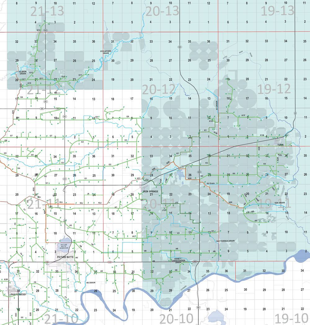
Water division maps show water divisions and infrastructure locations on top of a parcel map. Use these maps to determine which division your land is in and to understand how water is carried to your parcel, or to identify your Water District Coordinator.
Electoral district maps show board member representation areas on top of a parcel map. Use these maps to determine which board member represents you.
electoral Division Maps
Division 1
Term: May 2024 - May 2027
Current Representative: Peter Bos

The division is described as follows:
All that area of the Irrigation District in Parts of Townships 10, 11, 12 and 13 in Ranges 19, 20 and 21 lying to the East and North of a direct line from the Oldman River at the West boundary of the N.W. Quarter of Section 29 Township 10 Range 20 W4M proceeding North to Highway 519, continuing North from the S.W. corner of the S.W. Quarter of Section 4 Township 11 Range 20 W4M to the S.W. corner of the S.W. Quarter of Section 21 Township 12 Range 20 W4M, then continuing West to the S.W. corner of the S.W. Quarter of Section 20 Township 12 Range 21 W4M, then continuing North to the N.W. corner of the N.W. Quarter of Section 5 Township 13 Range 21 W4M.